Big Creek, May ID
In late-2011, QCI was approached by Jerry Myers, the Upper Salmon Project Manager, and a request was made to have the survey crew conduct a GPS reconnaissance level survey of the existing Big Creek culvert area. Site control was established using the Online Users Positioning Service (OPUS, http://www.ngs.noaa.gov/OPUS/) providing real world coordinates for our work. A quick survey (less than two hours in the field) was conducted to help identify important features to be considered in the preliminary design and permitting phase.
The reconnaissance survey identified the basic channel geomorphology in addition to site constraints created by the existing culvert, cabled utilities and roadway embankment. Additional data was added over the winter of 2012 to help identify information that will be required in the Biological Analysis and the Joint Application for Permits (USACE/IDWR).
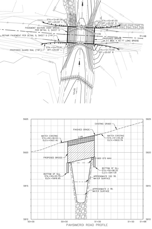
A preliminary design was quickly developed using AutoCAD Civi3D (2012) based on the results of the field survey and documents were prepared to help support the permitting process.
The preliminary design is presently being utilized to seek concurrence with nearby irrigators and the two County Road and Bridge Departments (Big Cr. serves as the Custer/Lemhi county line). Materials suppliers are also being provided with copies of the plan in an effort to find the best deal possible when the time comes to acquire the new structure.
The reconnaissance survey identified the basic channel geomorphology in addition to site constraints created by the existing culvert, cabled utilities and roadway embankment. Additional data was added over the winter of 2012 to help identify information that will be required in the Biological Analysis and the Joint Application for Permits (USACE/IDWR).
A preliminary design was quickly developed using AutoCAD Civi3D (2012) based on the results of the field survey and documents were prepared to help support the permitting process.
The preliminary design is presently being utilized to seek concurrence with nearby irrigators and the two County Road and Bridge Departments (Big Cr. serves as the Custer/Lemhi county line). Materials suppliers are also being provided with copies of the plan in an effort to find the best deal possible when the time comes to acquire the new structure.
|
|
|
Big Creek Images:
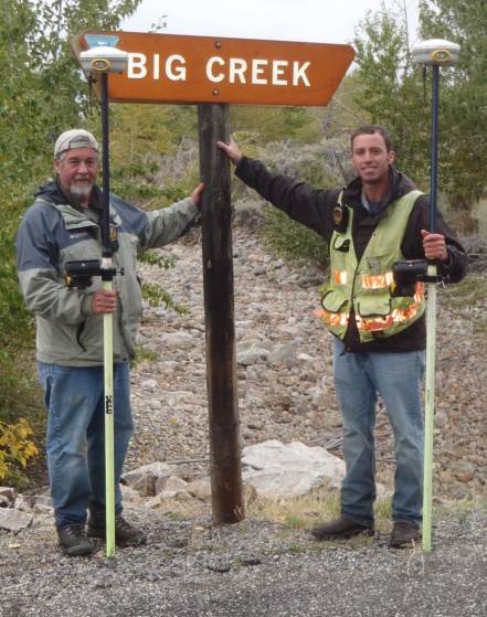
Left: Finding the knocked over sign helped validate that the crew was in the right location.
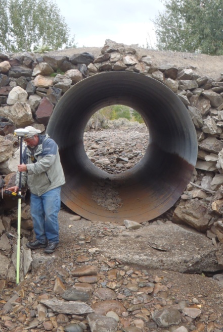
Middle:When spring runoff occurs on Big Cr., the existing 8-ft diameter culvert serves as a constraint, as observed by the water line.
Right: Preliminary plans have been prepared in support of the Biological Assessment being conducted by Trout Unlimited.
Left: Finding the knocked over sign helped validate that the crew was in the right location.
Middle:When spring runoff occurs on Big Cr., the existing 8-ft diameter culvert serves as a constraint, as observed by the water line.
Right: Preliminary plans have been prepared in support of the Biological Assessment being conducted by Trout Unlimited.
