boise city public works
|
Location
Client Date |
Boise, Idaho
Idaho Department of Fish and Game 1995-2012 |
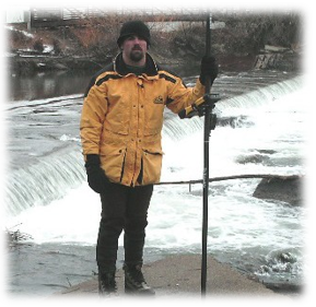
In midwinter 2008, Quadrant Consulting survey crews began the initial cross section survey work for the project that would eventually evolve into the Boise River Park. With the Boise River lowered to normal winter flows, the crews were able to wade the channel and survey using a combination of GPS and convention total station methods. Between Main Street and Veterans Parkway, cross sections matching the effective Flood Insurance Study (1998 field work) were resurveyed, while intensive surveying was conducted on the channel reach between the Thurman Mill Diversion Dam and the Farmers Union Ditch Company point of diversion. The information obtained by QCI was used for the Boise River Park’s Phase 1 design.
QCI crews conducted a similar survey in late-2008 for the property adjacent to Boise City’s Marianne Williams Park along the Boise River. Cross sections and a channel profile of the river were developed between Eckert Road and a location just downstream of the present East Parkcenter Bridge. Again at low water, the bulk of the surveying could be completed in the winter months by wading. However, the need to obtain accurate data immediately below the South Boise Mutual Irrigation Company’s Bubb Ditch diversion required the use of a boat to plumb the depths of the immediate downstream waters. Data obtained from this effort was utilized to prepare a No Rise Certificate for the Marianne Williams Park site and support a future Letter of Map Revision for the adjacent Barber Station site.
QCI crews conducted a similar survey in late-2008 for the property adjacent to Boise City’s Marianne Williams Park along the Boise River. Cross sections and a channel profile of the river were developed between Eckert Road and a location just downstream of the present East Parkcenter Bridge. Again at low water, the bulk of the surveying could be completed in the winter months by wading. However, the need to obtain accurate data immediately below the South Boise Mutual Irrigation Company’s Bubb Ditch diversion required the use of a boat to plumb the depths of the immediate downstream waters. Data obtained from this effort was utilized to prepare a No Rise Certificate for the Marianne Williams Park site and support a future Letter of Map Revision for the adjacent Barber Station site.
