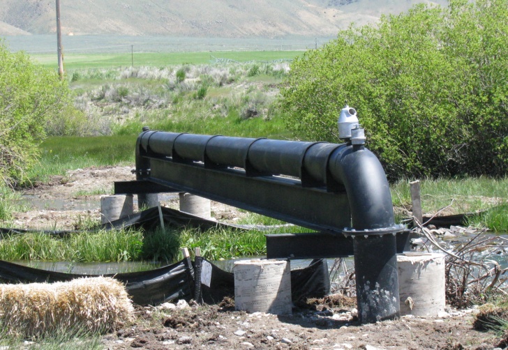
Big Timber/Canyon Creek Pump Station, M. Beyeler Project
|
|
Fish Habitat Restoration Program, Upper Salmon River Basin
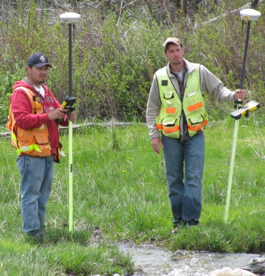
QCI provides professional surveying and design services to the IDFG Habitat Restoration Program. Projects for IDFG have included the Big Timber/Canyon Creek Pump Station and the Eagle Valley Ranch Diversion Consolidation and Pipeline designs. For the Big Timber/Canyon Creek project, QCI completed a GPS survey and engineering designs to relocate and consolidate existing irrigation diversions from Canyon Creek and Big Timber Creek to the main stem Lemhi River. The survey included a new point of diversion location, approximately 2,700 linear feet of pipeline alignments, and existing on-farm irrigation infrastructure. QCI then designed a variable flow, constant pressure irrigation pump station designed to deliver up to approximately 1,800 gallons per minute to an existing array of center pivot, wheel line, and hand line sprinkler systems, with an additional 630 gallons per minute for flood irrigation use.
The Eagle Valley Ranch project included site surveys for seven existing points of diversion and approximately 16,500 linear feet of pipeline alignment. The design phase of the project consolidated five points of diversion into three points of diversion and maintained irrigation deliveries to several existing sprinkler and flood irrigation systems. The project design also provided for diversion screening, removal of in-stream fish passage barriers, and irrigation flow rates ranging from 2 cfs to 8 cfs with operating pressures up to approximately 95 psi through approximately 16,000 feet of distribution pipeline.
In addition to the Big Timber/Canyon Creek Pump Station and the Eagle Valley Ranch Diversion Consolidation and Pipeline design projects, QCI has topographic surveys and design functions for the following habitat enhancement projects:
- Eagle Valley Spring Creek Culvert Replacement and Berm Removal - Replacement of a fish passage barrier that existed on a ranch along the Lemhi and restoration of adjoining grounds to provide habitat cover,
- Wallace Creek Culvert Design - Replacement of a fish barrier on Diamond Road in Salmon. Following initial topographic surveys and preliminary design, project implementation was completed by the Lemhi Soil and Water Conservation District, working in conjunction with the Office of Species Conservation, and utilizing the final design prepared by QCI.
- Sager Bank Restoration Project - Rick Sager, the Lemhi River Watermaster, had property where the Lemhi was creating new channel habitat and at the same time was eroding his property. Working with IDFG and Mr. Sager, QCI conducted a topographic survey and developed a bio-engineered solution that maintains channel habitat and stabilizes his river bank.
- Twelve-Mile Side Channel Enhancement - QCI established project control using GPS, combined with identifying site features to provide control for the side channel enhancement project. Once control was established, QCI provided construction staking for IDFG's contractor.
- Pahsimeroi Hatchery Diversions Topographic Surveys - QCI established a control network for the two Pahsimeroi fish hatchery diversions and conducted topographic surveys that included the stream channels, diversion structures, headgates, sheet pile cut-off walls and the concrete raceways.
- East Fork Salmon River Topographic Survey - QCI conducted a topographic and bathymetric survey of the lower mile of the East Fork of the Salmon River, near Clayton, ID.
- Miscellaneous Topographic Surveys - Under the Habitat Restoration Program, QCI has conducted topographic surveys for Meadow C., Trout Fry Cr., Little Springs Cr., the Snyder Side Channel, and the Mulkey Bank.
