Little Morgan Creek Reconnect Project, May, ID

The Custer Soil and Water Conservation District retained the HDR Team (HDR and Quadrant Consulting) to provide planning, design and construction administration services for the Little Morgan Creek Reconnect Project (LMC Project) in November 2001. This project was funded by the Bonneville Power Administration and was one of four projects given a high priority for completion by the Idaho Governor's Office of Species Conservation.
The LMC Project involved a number of interrelated variables that came into play when analyzing the watershed for stream restoration potential. Factors investigated included in the implementation of this project included water rights, irrigation efficiency, irrigation diversion design, fish screening, water conveyance, stream restoration, irrigation ditch crossings, property rights and landowner/irrigator responsibilities, a biological opinion, habitat improvement, historical cultural resources and stream connection.
The LMC Project involved a number of interrelated variables that came into play when analyzing the watershed for stream restoration potential. Factors investigated included in the implementation of this project included water rights, irrigation efficiency, irrigation diversion design, fish screening, water conveyance, stream restoration, irrigation ditch crossings, property rights and landowner/irrigator responsibilities, a biological opinion, habitat improvement, historical cultural resources and stream connection.
This project witnessed the first implementation in the Upper Salmon River Basin of LiDAR mapping, when the site was flown in November 2001. Quadrant Consulting provided the ground control and field validation for a 4,500 acre, remote sensing operation conducted by Airborne 1 Corporation based in El Segundo, CA. Mapping was completed prior to the beginning of winter and allowed the Team to utilize the winter season to complete the initial water rights assessment and to begin the preliminary design effort. Use of the LiDAR data provided the design team to begin work three months earlier compared to conventional aerial imaging. The project was completed to the 75% stage in the design process. Local irrigator support and additional funding will be necessary prior to the eventual completion of the project.
The upper image shows Little Morgan Cr in the background with the irrigated Whitworth Ranch farmland in the foreground.
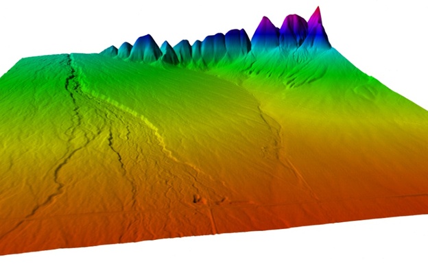
The lower image represents data acquired in support of the project in November, 2001, resulting in Little Morgan Creek project becoming the first LiDAR data set used for design purposes in the Upper Salmon River Basin. Quadrant Consulting provided ground control and field validation for the project.
The upper image shows Little Morgan Cr in the background with the irrigated Whitworth Ranch farmland in the foreground.
The lower image represents data acquired in support of the project in November, 2001, resulting in Little Morgan Creek project becoming the first LiDAR data set used for design purposes in the Upper Salmon River Basin. Quadrant Consulting provided ground control and field validation for the project.
