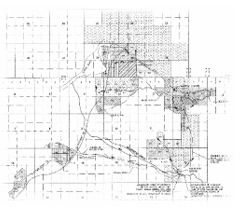
spread creek water rights mapping
|
Location
Date Cost |
Teton County, Wyoming
2011 $10,000 |
QCI provided a water rights review and updated mapping to the Wyoming State Board of Control to accommodate the change in point of diversion location related to the fish passage improvements facilitated by the Spread Creek Fish Passage Improvement Project. The project included a comparison of historic water right use based on record information with current irrigation practices over an approximately 5,300-acre area.
