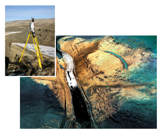
WSI integrated airborne LiDAR data with high resolution TLS cross sections of the Weiser River, ID canyon at a proposed dam site. TLS data was collected by the ID National Lab. Ground verification was provided by QCI.
Weiser River, Galloway Dam Site, LiDAR Mapping
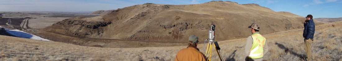
Watershed Sciences performed as the primary Contractor for a joint IDWR/USACE LiDAR mapping of the Galloway Dam Site on the Weiser River near the town of Weiser, ID. WSI acquired high density LiDAR data and 1-ft resolution digital orthophotos for 40,315 acres of river floodplain for a project funded by the USACE. The project goals included assessment of geomorphology and geology/faults in near vicinity of planned dam construction site. Quadrant Consulting provided an independent control network and validated over 1,000 points on the ground.
Ground based LiDAR data were also collected by Idaho State University researchers and made available to WSI for integration into the project point cloud and follow-up analysis. The Terrestrial LiDAR Scanning project was a cooperative community-outreach provided by the Idaho National Laboratory (INL) through the federally mandated Technical Assistance Program. Under this program, INL provided technical support along with specialized equipment in the form of a Riegl VZ-4000 laser scanner.
Ground based LiDAR data were also collected by Idaho State University researchers and made available to WSI for integration into the project point cloud and follow-up analysis. The Terrestrial LiDAR Scanning project was a cooperative community-outreach provided by the Idaho National Laboratory (INL) through the federally mandated Technical Assistance Program. Under this program, INL provided technical support along with specialized equipment in the form of a Riegl VZ-4000 laser scanner.